
Aurora, Oregon: Ground Zero For Disaster – Part 2 Preview.
This full episode premieres Friday, July 10. Click for the preview of Part 2 below.

Aurora, Oregon: Ground Zero For Disaster – Part 2 Preview.
This full episode premieres Friday, July 10. Click for the preview of Part 2 below.

People camping just outside of Aurora, Oregon today are enjoying life at the site of an erased civilization. They have no clue they’re standing at ground zero of the most violent, destructive natural disaster in Oregon’s recorded history. Click the image below for Part 1 of this compelling story.
And though it remains the granddaddy of them all…you’ve never even heard of it….even with the epicenter nearby. And while Aurora’s town and rural areas were hit hard, outskirts like this were wiped virtually clean. There were winners and losers, with one nearby community holding on and the other now inhabited mainly by passing tourists, with no idea of what happened. So what was this disaster and why haven’t you heard about it? This is the battlefield of a community that fought…and lost badly …with that big battle occurring under a frightening set of events.

BIGGER THAN 1996
Whether it’s an earthquake, lightning strike or flood, natural disasters each tend to provide their own frame of reference. Many Oregonians recall the 1996 flood in much of the Willamette Valley. That regional soaker became a benchmark for water disasters. Yet here’s what’s left out: There’s a flood by comparison that was worse…and it isn’t even close. The flood of 1861 stands as the all-time record holder for the most disasterous on the Willamette River. That 1861 flood barrelled through at 635,000 cubic feet per second, being half again worse than the 1996 flood and packing more than seven times the punishing power of Niagara Falls.
AREA MAP: LAY OF THE LAND

CALM BEFORE THE STORM
The 1861 Willamette River flood was the result of a perfect storm: A ‘Pineapple Express’ weather event that unfolded in two distinct phases. Because November, 1861 was unusually cold and snowy, first came heavy snow accumulation. Then the situation got worse…much worse…because after that massive snow drop, next came a tropical cyclone with strong winds…and that part happened fast…with most of the warmer rainfall compressed into just 72 hours, rapidly melting the dense snowpack.
The result? Flash flooding…which is what made the 1861 disaster so devastating. It triggered a sudden surge of runoff into the Willamette River, with a flow greater than the mighty Mississippi, raising water levels to record highs. As a result of that thousand year event, much of the Willamette Valley became a freshwater ocean…the size of 273,000 football fields and more than half the size of Rhode Island.

WHEN THE RIVER BECAME A WEAPON
In 1861 around Aurora, water was cresting by December 5th. Yet the real damage was just getting started, because here’s something people don’t realize: Water alone wasn’t the deadliest part. That’s because the Willamette River was now weaponized. Water cresting, the river was armed and dangerous, fully loaded with a quiver of mountain timber. Soil now softened, fir trees were uprooted and fell like dominos, then raced torpedo-like with the fast running current. Local Butteville pastor Reverend Michael Fackler wrote in amazement about pitch-black currents carrying massive fir logs up to 200 feet long.
SHOWDOWN AT GRAHAM’S FERRY
Graham’s Ferry was at a critical bend in the river and where colossal trees were turning into battering rams. They tore ferry cables, leveled orchards and pushed buildings over with ease. Imagine waking up in the freezing darkness of December to the sound of roaring water and 200-foot missiles snapping your house in half. Use heavy, low-frequency “thuds” and wood-splintering sound effects in the audio mix. Timber pierced through the current, slamming into lowlands around Graham’s Ferry and Butteville Road to devastating effect. The sheer force of massive logs, swinging Paul Bunyan-like, clubbed everything in their path, leaving heaps of scattered lumber across French Prairie as the water receded.

FLOODING AND FIGHTING
By December 1861, the United States was entering its first, bloody Christmas of the Civil War as President Abraham Lincoln struggled to heal the fractured Union. Back east, soldiers prepared for the brutality of battle by digging trenches in Virginia. But here in Oregon, pioneers fought a very different enemy, digging out from the massive heaps of French Prairie mud covering where their towns used to be. As Civil War soldiers raced toward each other, in Oregon, survival depended on racing from a rising river.

At Champoeg—the very birthplace of Oregon’s first government—the water reached a mind boggling 30 feet depth. Famous as the site of Oregon’s first provisional government, Champoeg was submerged under about 30 feet of fast-moving water. Every structure was swept away except for the Hudson’s Bay Company warehouse.

AFTERMATH
During the late 1800’s, railroads gradually replaced the steamboat for transporting the area’s freight and passengers, with Champoeg declining as a trade center. Some residents attempted to rebuild, but another flood decades later permanently ended their efforts as the buildings at Champoeg were again swept away. The hopelessness of re-establishing a town at Champoeg was eventually understood, leading to its abandonment in 1892. Champoeg is now a State Park.

WINNERS AND LOSERS
Yet an Aurora area community survived…and though it’s small, it’s still here. That place? Butteville, Oregon.

So what about another nearby French Prairie area, like nearby Donald, Oregon? Donald didn’t even exist then, developing into a town decades later. As a result, damage to that area was pretty much limited to what was then largely French Prairie farmland.
WHY DID CHAMPOEG DIE WHILE BUTTEVILLE SURVIVED?
Geography helped. Champoeg wasn’t destroyed because it sat dramatically lower than Butteville. Instead, it was just a few extra feet of elevation. Yet when floodwaters spread across French Prairie, that made all the difference. This hill just outside of Butteville—known by its French Prairie derived name of La Butte is a hard volcanic basalt escarpment that gave Butteville its name. At 427 feet elevation, it doesn’t seem that tall. Yet this seemingly non-descript hill would have represented higher ground to those seeking refuge during the 1861 flood. The elevation of La Butte was above the 30-foot floodwaters that also completely obliterated the lower-lying town of Champoeg.

Along with Champoeg, the 1861 flood completely destroyed several other Willamette Valley towns, mills and bridges never designed to withstand such pressure. A few of these were:
1. Linn City: The bustling mill town of Linn City was swept away and eventually replaced by the town of West Linn.
2. Orleans: Just across the Willamette River from Corvallis, Orleans was completely washed away and never re-established.
3. Santiam: A short drive from Albany, the town of Santiam is another community erased by the 1861 flood and and never rebuilt.
So the next time you’re driving around Aurora between Butteville and Graham Road along Butteville Road, or camp at nearby Champoeg Park, look around. You’re on the site of Oregon’s greatest-and most forgotten-disaster.


Aurora, Oregon Is Shaken, But Not Stirred
It’s a story with all the workings of a well hidden caper. That’s because under the cover of night, this true event featured an elaborate undercover operation…with a secret hideout near Boones Ferry Road on the outskirts of Aurora, Oregon, including a unique transportation hub to evade detection. The stakes are also high and law enforcement is hot on the heels of criminals and actively working to track them down. Except this is one story you’ve never heard before.
The Setting: 1930’s Aurora, Oregon
It’s the evening of October 3, 1936 and federal authorities are readying a criminal takedown. But this isn’t a misdemeanor sting on a few two bit punks. The men on these outskirts of Aurora, Oregon, are smugglers, with their center of operation a short strip of land between current day Charbonneau and nearby Boones Ferry Landing. It’s the length of maybe a few football fields. From there, they move their contraband across the Willamette River, north to Wilsonville and on to greater Portland.
Law Enforcement: On The Case
The information given to law enforcement involves a liquor distillery on the periphery of Aurora, with that liquor traveling across the Willamette River to Wilsonville. With this tip, officers begin their surveillance from the Wilsonville side of the river. Their surveillance pays off big-time, as the lawmen notice a heavily loaded truck cross the ferry to Aurora’s backyard known as French Prairie on the north end of Oregon’s Willamette Valley.

French Prairie
Located south of the Willamette River, the area was settled in the 1800’s by French-Canadian frontiersmen and trappers. It became a strategic crossroad for smuggling contraband. That’s because roads and rivers have long been plentiful around Aurora. The old Pacific Highway — now called Highway 99E — passes through town, connecting Portland to Salem. Boones Ferry Road has also long connected both of those major cities. As for waterways, both the Pudding and Willamette rivers meander past Aurora. Each route gives moonshiners options to evade government detection. For lawmen trying to intercept illegal hooch, it becomes a ‘cat and mouse’ game.
Getting the Lay of the Land
After a few nights of watching, law enforcement spots the same truck again crossing from Wilsonville on Boones Ferry Road. It then takes Boones Ferry across the Willamette River. Officials follow it to the old Wagner farm, now part of present day Charbonneau, but then the site of a distillery and storage facility.

Hide & Seek
As officers watch from a nearby field, one early distillery giveaway is the smell of fermenting mash. Sounds emanating from a water pump also revealed what was for that time a state-of-the-art mechanized well. Law enforcement then observes trucks leaving with lights off. It’s then a short drive from the distillery to Boones Ferry Landing, then across the Willamette River, back to Boones Ferry Road on the Wilsonville side and north to Portland. Minimal road exposure means little risk of being spotted by passing lawmen on a main highway. And by operating without lights, it’s clear the smugglers know their way around…even in the dark.
Secret Sauce
Over multiple nights, officers observe even more heavily loaded trucks, plus a car driving in and out of the Wagner farm property. Further surveillance finds men unloading bulky items at the distillery, then loading what appear to be containers of liquor. The crooks are clever to avoid detection on the road…and in hiding their distillery, too. That’s because their distillery is located within a separate enclosure, surrounded by a high fence of chicken wire. It also has an early warning system, plus a yard gate, approachable only through the Wagner residence.
Law Enforcement Takedown
Fast forward To the night of October 3,1936, when just before the bust, federal officials hear the perpetrators comment “We’ll run the mash tomorrow night,” with mash a key ingredient for making moonshine liquor. One officer then notices a still and related paraphernalia, including an industrial size 25 pound package of yeast, another component of home brewing. But to these federal officials, most noteworthy is the bottle containing an amber colored fluid, classic for whiskey, with no revenue stamps attached. This is the felony act.The entire operation is soon disrupted for good. Federal agents move in with their raid when one defendant walks out of the building to retrieve yeast, returns to the building and is arrested while entering his car. Several other men on the Wagner farm are then arrested.
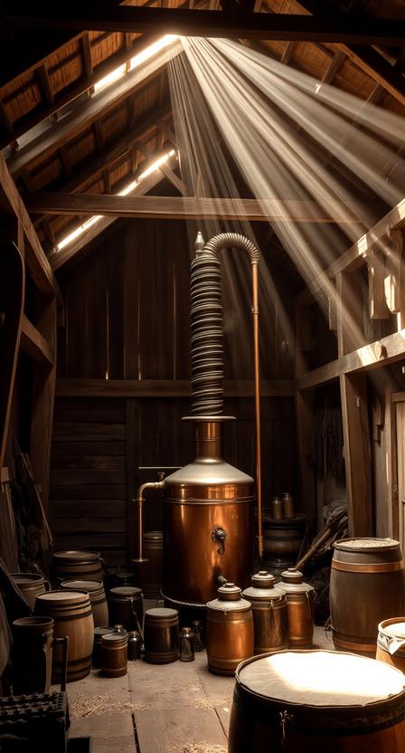
White Lightning
What’s significant isn’t so much that this arrest happened, but WHEN. That’s because it occurred AFTER Prohibition, once alcohol use had again been legalized. That irony is deep as the nearby Willamette River. So what gives? One word: Taxes. So the men running liquor through the hinterlands of Aurora weren’t violating Prohibition laws. Instead, given their possession of four gallons of moonshine whiskey, they were violating federal tax law, the liquor tax act. The actual charge was the removal, concealment and transportation of non-tax paid liquor, the same kind of federal tax beef that sealed mafia kingpin Al Capone’s fate when government couldn’t make his other mob-related charges stick.
Prohibition Over
The case is decided years after Prohibition’s 1933 repeal. By then, the public had largely moved on from arguments about alcohol. Bootlegging arrests began as front-page news during the 1920’s, because that was part of a national discussion on Prohibition. Yet by 1937, that argument was settled. This meant that a moonshine bust around Aurora was now more of a tax evasion case, not a referendum on drinking alcohol.
What Happened To The Distilling Defendants?
District Judge James Fee renders his decision on March 22, 1937, giving the ringleader four years of hard labor at McNeil Penitentiary in Washington State. His associates were given lesser sentences and the farmowner received a suspended sentence, but required to pay a hefty fine for the unpaid tax value of all the liquor accounted for.
Sentence Appealed
The main character’s four year sentence is later appealed on Fourth Amendment grounds about unwarranted search and seizure, but that challenge fails, finding officials had sufficient probable cause for search and seizure of alcohol without the payment of required federal tax. History lives on. That’s because the Wagner farm was later annexed into Wilsonville’s Charbonneau neighborhood on the Willamette River’s south bank. The district traces its name to Jean Baptiste Charbonneau, a son of Sacagawea who traveled with his mother on the Lewis and Clark Expedition as an infant.

The Site Today
Even now you can observe an existing remnant at the center of this distillery drama near the former Wagner farm site. Passing through Charbonneau’s northern section on the appropriately named French Prairie Road, you’ll see a tall wooden structure. That’s the old Wagner farm well location, sitting on the same land where a hidden distillery operated behind a chicken wire fence, as trucks ran without lights on their way to Boones Ferry Landing…and where federal officers smelled fermenting mash, as they monitored the scene from a neighboring pasture. Ironically, those same grounds are now part of a posh golf community.

Part of that same Wagner farm was once owned by someone with a storied Boone connection, since it was once part of the Boone family’s long held land claim. So Chloe Boone, great granddaughter of Daniel Boone, married Oregon’s last territorial governor, George Curry. Part of that Curry House land later became the Wagner farm where the takedown occurred. So the next time you’re driving on the outskirts of Aurora near Charbonneau, consider taking a pleasant detour and observe what remains of this interesting local history. You can also learn about the origins of Aurora, Oregon’s historic Boones Ferry in the video below.

You’re driving one of Oregon’s oldest roads. Not a freeway, not a bypass, but a road with a story, stretching back nearly two centuries.
But here’s what most people miss.
Many assume this road was named for Daniel Boone — the famous frontiersman. And they’d be wrong. Daniel Boone never set foot in Oregon…but his grandson, Alphonso Boone, did.
Like his grandfather Daniel Boone, Alphonso looked west.
Through brutal terrain, river crossings, the constant threat of illness and hostile territory, the Boones made it across the Oregon Trail in 1846 with ten kids in tow, settling along the Willamette River, not far from the town of modern day Aurora.
When Alphonso and his family arrived in Oregon in 1846, they saw what was needed: A way to cross the river.
By 1847, Alphonso Boone and his eldest son Jesse built a ferry crossing on the Willamette, appropriately named Boones Ferry.
The Boone family insisted the ferry run 24 hours a day, 7 days a week — in a time with no electricity, no engines, and no guarantee of traffic. This meant manual labor using oars.
But a ferry alone wasn’t enough. To make the crossing useful, you also needed a road to get to it.
So as the ferry moved people across the river, Daniel Boone’s great grandson Jesse began clearing the path to make a road connecting Portland to Salem.
Driving Boones Ferry Road today, no one pictures the challenge of what building a road then and there meant, without today’s machinery. Plus when rains hit, ground turned to mud. The need was real.
So logs were split in half lengthwise, then laid flat-side up across the road surface — creating a continuous wooden mat over soft ground.
As a result, the labor intensive, corduroy constructed log road ran north toward Portland and south toward Salem, passing through Marion, Washington, Clackamas and Multnomah Counties. That road became Boones Ferry Road.
So why does all this matter today?
Because Boones Ferry and the road leading to it were the commercial and cultural spine of Oregon. Boones Ferry Landing and the road connecting to it became the first viable land link between Oregon’s key cities, including Salem, our state capital and the booming Portland/Vancouver region.
Farmers, merchants, government officials — everyone moving goods and transacting business passing through here used Boones Ferry Road. So the road you’re driving right now, was once the busiest corridor in the territory, literally bringing the state together.
So what does that mean to you and me?
Fast forward to now, nearly two centuries later and Boones Ferry Road is still doing what it was built to do: Move people. Interstate 5 runs right alongside it, almost exactly where the Boone family cleared the trail now known as Boones Ferry Road.
First came Boones Ferry Road and then the I-5 highway. Boones Landing is where it all started. The community that grew up around it was named Wilsonville in 1880, after the town’s first postmaster.
But if you think that’s surprising, consider this:
The ferry itself operated for an extraordinary 107 years and shut down in 1954 with the completion of Interstate 5 and Boone Bridge, a literal stone’s throw from the original ferry landing.
The Oregon Trail spirit — move west, build and connect people — runs directly beneath your tires every time you take Boones Ferry Road…and Aurora is at the heart of it.
So the next time you’re on Boones Ferry Road, you’re basically driving the same path a family began in the Aurora, Oregon wilderness in 1846. If you want to learn about another side of Boones Ferry Road few know about, check out that interesting feature article here or its companion YouTube video below…about ‘Booze Ferry.’

Thinking about buying a home in Aurora, Oregon? There are 6 alarming things most Aurora, Oregon homebuyers never find out, until it’s too late. If you’d like to know some unique facts about Aurora, click here. Otherwise, watch the helpful video below before you buy any Aurora, Oregon property!

Given Aurora, Oregon’s lengthy history, there are some interesting facts about this unique town you may not know. Here are seven interesting ‘info nuggets’ about Aurora, Oregon.

Fact #1. Aurora is older than the state of Oregon!
The Aurora Colony was founded in 1856, roughly 3 years before Oregon’s founding in 1859.

Fact #2. Aurora Has A ‘Secret’ Cemetery
One of Aurora, Oregon’s best-kept secrets is among its most historic. There are numerous area cemeteries. These include Aurora Community Cemetery, plus nearby Butteville and also Champoeg. Yet the one with the biggest connection to Aurora is tiny Keil Cemetery, situated off a graveled, little-used lane called Cole Road near Aurora’s west side. Founder Wilhelm Keil is buried here, as are his family members. Noteworthy is the burial site of Dr. Keil’s daughter Aurora, the town’s namesake. Keil Cemetery also is where an American hero rests and you can learn more about that story here. The cemetery is little visited because access requires crossing private property.

Fact #3. Aurora Has A Long Culinary History
Aurora has good modern day restaurants, plus an exceptional history of fine dining. Ben Holladay, president of the Oregon & California Railroad, worked out an arrangement with Aurora’s founder, Dr. Wilhelm Keil to feed train passengers at Aurora with the settlement’s renowned cuisine. The food was so good in Aurora that travelers and train workers would bypass eating at other railroad stops, making a point to dine in Aurora.

Fact #4. Aurora, Oregon Is An Aviation Powerhouse
The Aurora State Airport is Oregon’s third busiest. Yet given its relatively small size, some might call the Aurora Airport a ‘mighty midget.’ Originally constructed during WWII as a military support airbase to Portland, the Aurora Airport is now a vital economic hub with vibrant businesses, including two helicopter heavyweights, Columbia Helicopters and Helicopter Transport Services.

Fact #5. Aurora, Oregon’s Unique Geography
Aurora is a town, but also encompasses a far larger country setting, too. Greater Aurora is located virtually equidistant between the major metro areas of Portland & Salem. Learn more about Aurora, Oregon’s unique geographical diversity in this video overview. Aurora’s 97002 zip code also straddles of both Clackamas & Marion Counties. So depending on your specific location, this means two completely different school systems (Canby & North Marion) and property tax systems (Marion & Clackamas Counties).

Fact #6. Aurora Colony Days
Aurora’s Colony Days is a multiple day celebration of Aurora pageantry held every August. Features include a parade, marketplace, concerts, beer garden and even a 5k run/walk. It’s a family-friendly environment with something for everyone.

Fact #7. Yes, There Are Antiques, Too
Among Aurora’s commonly known, modern-day ‘claims-to-fame’ is its antique heritage. In fact, to many, antiques have long been Aurora’s main attraction. Given its small town charm and pedestrian friendly design, weekends are especially popular for many to visit downtown Aurora, Oregon.

Are you interested in buying or selling an Aurora, Oregon home? Call or text your Aurora real estate specialist, Realtor Roy Widing with Certified Realty for a free consultation at 971-258-4822.
